Public Health + Public Space

Health is an important societal topic in the Netherlands. In one of the most densely populated countries in the world, healthy living environments reduce diseases, deaths, healthcare costs, and shifts focus from prevention and medicalising on the individual levels to taking care of communities. Still, for example, the air quality in the Netherlands is considered moderately unsafe, resulting in the highest rate of asthmatic children worldwide. The same goes for recordings of diseases related to polluting substances on land and in water. This makes public spaces social determinants of public health. We see similar correlations when it comes to the presence of infectious microbes and parasites, and environmental stress. Especially in world port-cities like Rotterdam unhealthy conditions coincide with unequal socio-spatial patterns. Here the impact on individual health is largely untraceable. Understanding the impact of inherent industrial and human activities on urban areas at the neighbourhood level and crossing it with heterogeneous data sets help us understand the socio-spatial impact of pollution-related and vector-borne diseases on cities. Measuring environmental pollution in public spaces can tell us e.g. more about the impact of air quality on citizens as a group. Statistical time series and cross-sectional data analyses can be applied to generate valid correlations if they are made geo-specific. By using machine learning and AI technologies we cross data on environmental pollution with other heterogenous socio-spatial and temporal data sets. The use of mapping, spatial statistics, and urban narratives including historical data can lead to a better understanding of the lived experience at the local level. Through workshops at the local level and notably in the public spaces of the city, we engage the general public and local decision-makers in discussions on public health using advanced computer models for visualisation. The Rotterdam case study provides insights applicable in other cities internationally.

See: Dutch Research Agenda (NWA) initiative on Public Health and Public Space

Biographies of Places

Today, historiographies seem to have moved away from traditional political and diplomatic histories describing cities towards social and cultural approaches. In general, this current shift of interest follows a Late-Modern turn toward the marginalized and marginalizing evidence, and thus explicit hypotheses are tested, and, among others, unbiased data is collected by current biographers. Still, certain narratives stay manifest. Also in Rotterdam. Here, bifocal narratives on the world port and the cosmopolitan city, and the dichotomy among these territories, remain persistent in the most recent biographies. What is seen in everyday space does not match this ontology generally applied in Rotterdam. To greater extent, as such, the samples of the biographies of public spaces as places help to fulfill the most essential public function of researching and abiding justification, while reinvigorating the critical public present in spaces. By opening up to the multiplicity of narratives, the article ‘The Port-City Portrayed in its Public Spaces: Introducing Micro Biographies of Places’ is able to focus on descriptions of Rotterdam which fall outside the scope of the current conventional. Through the lens of ‘biographies of places’, this study particularly follows the so-called material turn, in difference to stories of lives or narratives on actor networks. Hence buildings and artifacts placed in context, are the principal unit of analysis, for a multidimensional interpretation of urban sites across regions and periods.

The approach is operationalized by linking the urban and architectural design of public space, with studies of urban history, literature, cartography, and other urban humanities. This integrated perspective on port-cities is put forward most recently in a wider variety of projects at the LDE Centre of PortCityFutures, which has been promoted and supported for the approach below.

Harteveld, M.G.A.D. (2021) The Port-City Portrayed in its Public Spaces: Introducing Micro Biographies of Places. In: PortusPlus: the Journal of RETE (Association for the Collaboration between Ports and Cities). Venice: RETE, Vol. 12.

See also:
Port-City Perspectives
Maritime Mindsets

Port-City Perspectives


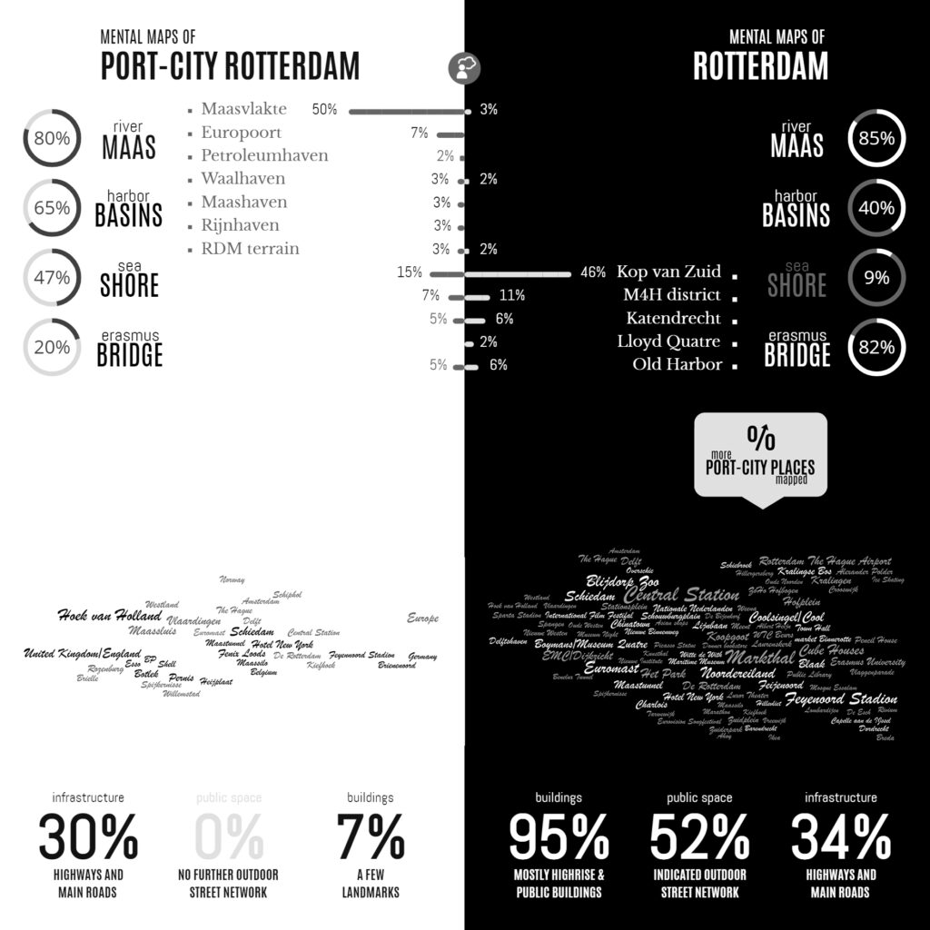
Infographic of the Comparative Analyses on the two Sets of Mental Maps

In the Minds of People: The Case of Rotterdam

Following the geographical ‘Any-Port Model’, urban design has stipulated and enforced the disunion of port and city over the recent decades. In conjunction with other disciplines, the emphasis has been laid at the dislocation of production activities in favour of logistic-productive dynamics. At the same time, the professional focus was on the urban areas where most citizens are. While this practice has led to the redevelopment of abandoned harbour areas too, foremost the approach stimulated stronger physical boundaries between lived city and the remaining and new harbour areas. This article describes the application of the dominant model in Rotterdam over the recent decades, on the basis of literature review, and, it confronts this with the concepts of Rotterdam which are in the minds of professionals-in-training, through the method of ‘mental mapping’. On the one hand, mainly harbour areas are memorised when respondents are asked to draw the port-city of Rotterdam, even though its efficient port infrastructure makes public space in these areas rare, and most harbours are located behind inaccessible borders. On the other hand, civic areas, which have a refined network of public spaces and are places for daily life, reveal also all kinds of tangible and intangible signs and symbols related to characteristics of the port-city when memorised; even more. Various elements, linked to water-land or the flows of goods, people, and ideas, dominate the minds of the people when they think of Rotterdam in general. These outcomes reconfirm the unique unity of port and city and provide a way to find an alternative or supplementary model accepting the complex nature of port-cities.

Read:
Harteveld, Maurice (2021) In the Minds of People: Port-City Perspectives, The Case of Rotterdam, In: European Journal of Creative Practices in Cities and Landscapes (CPCL), Vol. 4, No. 2.

See also:
Maritime Mindsets
Biographies of Places

[Re]Thinking Cities

2020: A Year without Public Space under the COVID-19 Pandemic!
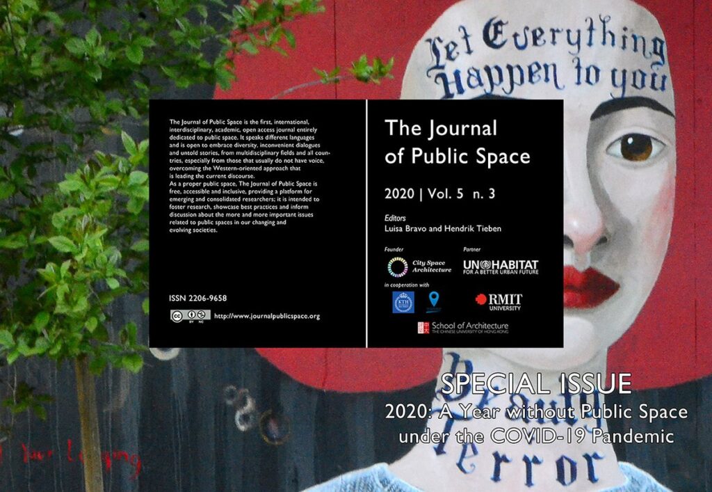
new publication of The Journal of Public Space

The Journal of Public Space published ‘2020: A Year without Public Space under the COVID-19 Pandemic’. This monumental publication of 280 pages witnesses the year we all lived on social distance dictated by COVID-19 health emergency, a measurement severely affected everyone’s access to public space and with it creating a range of impacts on different levels. Delft University of Technology, as a worldwide recognised leader in the field of urban design and public space, united with more than twenty universities globally to question; how can we face this unprecedented emergency and get prepared to its consequences, with specific regard to health disparity? Will public space restrictions stay in place after the recovery period? Should we just aim to return to a pre-COVID status quo, or for a ‘better normal’? And more generally, what will be the future of public space?

Maurice Harteveld, part of the scientific board, remembers how the situation induced by the COVID-19 crisis in early 2020 immediately brought together the global community of experts on the Design of Public Space; “I remember how the alarm bells didn’t stop anymore in the third week of April. Health situation worsened progressively in China, and a new decree imposing quarantine became in act in Northern Italy. Public space was abandoned there. Without doubt, we started to share local insights and form a global perspective on the issues arising from the pandemic for public space the current situation of public space.” Together with UN-Habitat, the United Nations Human Settlements Programme, this became an opportunity to collaborate to re-think how cities should be.

As the pandemic was moving across different continents and urban conditions, through shared online initiative public space experts across the world exchanged experiences of care, solidarity, entrepreneurship, academic perspectives, artistic interpretations, and creative practices of human resilience, engaging more than 100 speakers during 20 webinars from May to September 2020, and more than 2,700 registered attendees from over 80 countries, including representatives from UNHabitat. Global impact of the online initiative ‘2020: A Year without Public Space under the COVID-19 Pandemic’ has been even broader by counting more than 72,000 page views in that same period. This publication encapsulates key learnings globally from the early stage of the pandemic, which stand relevant to this day when we face squarely the same issues as we step into gradually and navigate the post-COVID era.

Download full issue here

Images of Port-Cities

In this video, you will get an explanation on how mental maps help us to (re)imagine port-cities in two steps: First, by explaining generally why people draw what they draw, and second, by explaining how images of port cities, as displayed in mental maps, are rooted and influenced by cultural frameworks of experience, and how they are biased according to the particular background of the beholder.

This educational video is part of the course Re-Imagining Port Cities: Understanding Space, Society and Culture available for free via online-learning TUDelft , and at the EdX MOOC platform. ©️ TU Delft, released under a CC BY NC SA license.

See also: the introduction video on Mental Mapping and the full MOOC on EdX: (Re)Imagining Port Cities: Understanding Space, Society and Culture

Mental Mapping

In this video, you hear more about the concept of a ‘mental map’, the mapping method, or the underlying theory, and why it matters, and how you can use it to educate others.

But before you watch, choose a port-city, and do a small exercise: sketch a map of your port city from memory.

If you have trouble getting started, just imagine you are walking through your port city. What would you see on the way? Are there specific elements or landmarks that stand out? Those are the kind of elements to include in your map. And don’t worry about getting all the details exactly right, it is just a sketch…

  • Do this all by yourself: close your laptop, put your tablet to sleep, turn your smartphone around, do not consult any books, and do not talk to anyone…
  • Draw your map on a blank, unlined sheet of paper, and don’t spend more than ten minutes on this task!

    Don’t worry about details; this map is not meant to be perfect!

    This educational video is part of the course Re-Imagining Port Cities: Understanding Space, Society and Culture available for free via online-learning TUDelft , and at the EdX MOOC platform. ©️ TU Delft, released under a CC BY NC SA license.

    See also: the subsequent video on Images of Port Cities and the full MOOC on EdX: (Re)Imagining Port Cities: Understanding Space, Society and Culture

  • Mapping Maritime Mindsets: Mental Maps

    Imagine: You are asked to draw a port city from memory. What would you put on paper? Do you think of harbours? Water, docks, cargo, moving loads, and ships? If your drawing shows these elements, don’t be surprised. Sixty-five graduate students also took on the challenge. In answering: “draw the port city of Rotterdam by mind”, the drawings of the participants (fig.1) displayed exactly the above features. Of course, this makes sense. A port just happens to be a place on the water in which ships shelter and dock to (un)load cargo and/or passengers. A harbour is a sheltered place too, and in its nautical meaning, it is a near-synonym for sheltered water, in which ships may dock, especially again for (un)loading. So, all the above linguistic lemmas are there and all these are connected to imaginable objects.

    Keep reading on Port City Futures | Leiden•Delft•Erasmus

    Design for Values Symposium

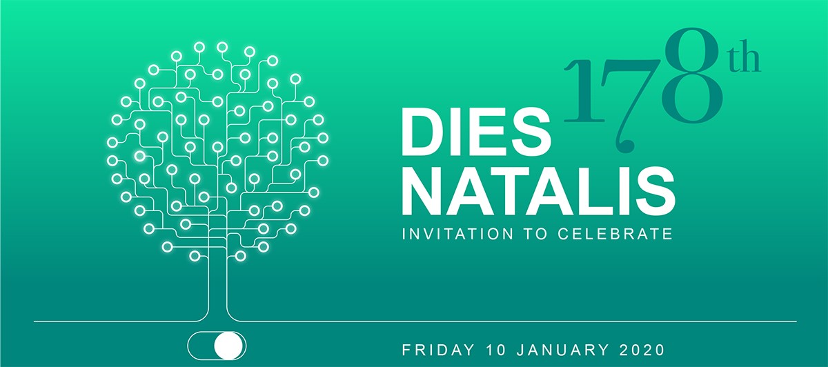
    On the occasion of its Dies Natalis celebration, the Delft University of Technology together with the Delft Design for Values Institute has organised a symposium on Design for Values.

    Design for Values means making design choices with explicit reference to and for reasons of moral and social values throughout the entire design or engineering process. The symposium centers around research supporting design for values, with a focus on Value Dynamics (how to design for values that change over time) and Value Conflicts (how to deal with frictions that emerge between two or more values within design and engineering processes).
    Continue reading

    Architectural and Urban Design for Values

    In a Dies Satellite Event celebrating the 178th anniversary of the TU Delft, the Faculty of Architecture and the Built Environment introduces their collaborative research on values to a wider audience, as it is present and emerging within its rich set of disciplines, including architectural and urban design, building technology, process management, and geo-information science. The faculty answers on the questions: How to deal with value dynamics when designing for values? How can we successfully operationalise values to inform design decisions, whilst anticipating possible value changes? How does the theory apply to specific application areas, such as architecture and urban design?
    Continue reading

    Democratic, Inclusive, Agential Cities


    This article highlights the dynamics of values in our reasoning on public space. By means of an epistemological study, illustrated by examples in the Dutch city of Amsterdam, it tests the contemporary premises underlying our ways to safeguard the inclusive, democratic, agential city, and, as such, it aims to update our view on public space. The article raises three subsequent main questions: [i] Is the city our common house as perceived from the Renaissance onward, containing all, and consequently are public spaces used by the people as a whole? [ii] Is the city formalising our municipal autonomy as emphasised since the Enlightenment, in an anti-egoistic manner, and in this line, are public spaces owned by local governments representing the people? And, [iii] is the city open to our general view as advocated in Modern reasoning, restricting entrepreneurial influences, and synchronically, is its public spaces seen and/or known by everyone? – Inclusiveness, democracy, and agentiality are strongholds in our scientific thinking on public space and each issue echoes through in an aim to keep cities connected and accessible, fair and vital, and open and social. Yet, conflicts appear between generally-accepted definitions and what we see in the city. Primarily based upon confronting philosophy with the Amsterdam case for this matter, the answering of questions generates remarks on this aim. Contemporary Western illuminations on pro-active citizens, participatory societies, and effects of among others global travel, migration, social media and micro-blogging forecast a more differentiated image of public space and surmise to enforce diversification in our value framework in urban theory and praxis.

    Read full article online:
    Harteveld, Maurice (2019) ‘Reviewing Premises on Public Spaces in Democratic, Inclusive, Agential Cities, illustrated by Amsterdam’, In: The Journal of Public Space, 2019, Volume 4, Number 2, pp. 123-143

    The Journal of Public Space is open access, contents are freely accessible under Creative Commons Attribution-NonCommercial 4.0 International License (CC BY NC).

    For the full issue: Vol. 4 n. 2 | 2019 | FULL ISSUE

    Editors: Maurice Harteveld and Hendrik Tieben
    Managing Editor: Luisa Bravo
    Publisher: City Space Architecture / UN-Habitat