Health is an important societal topic in the Netherlands. In one of the most densely populated countries in the world, healthy living environments reduce diseases, deaths, healthcare costs, and shifts focus from prevention and medicalising on the individual levels to taking care of communities. Still, for example, the air quality in the Netherlands is considered moderately unsafe, resulting in the highest rate of asthmatic children worldwide. The same goes for recordings of diseases related to polluting substances on land and in water. This makes public spaces social determinants of public health. We see similar correlations when it comes to the presence of infectious microbes and parasites, and environmental stress. Especially in world port-cities like Rotterdam unhealthy conditions coincide with unequal socio-spatial patterns. Here the impact on individual health is largely untraceable. Understanding the impact of inherent industrial and human activities on urban areas at the neighbourhood level and crossing it with heterogeneous data sets help us understand the socio-spatial impact of pollution-related and vector-borne diseases on cities. Measuring environmental pollution in public spaces can tell us e.g. more about the impact of air quality on citizens as a group. Statistical time series and cross-sectional data analyses can be applied to generate valid correlations if they are made geo-specific. By using machine learning and AI technologies we cross data on environmental pollution with other heterogenous socio-spatial and temporal data sets. The use of mapping, spatial statistics, and urban narratives including historical data can lead to a better understanding of the lived experience at the local level. Through workshops at the local level and notably in the public spaces of the city, we engage the general public and local decision-makers in discussions on public health using advanced computer models for visualisation. The Rotterdam case study provides insights applicable in other cities internationally.
Images of Port-City Rotterdam, through the Mental Mapping Methods
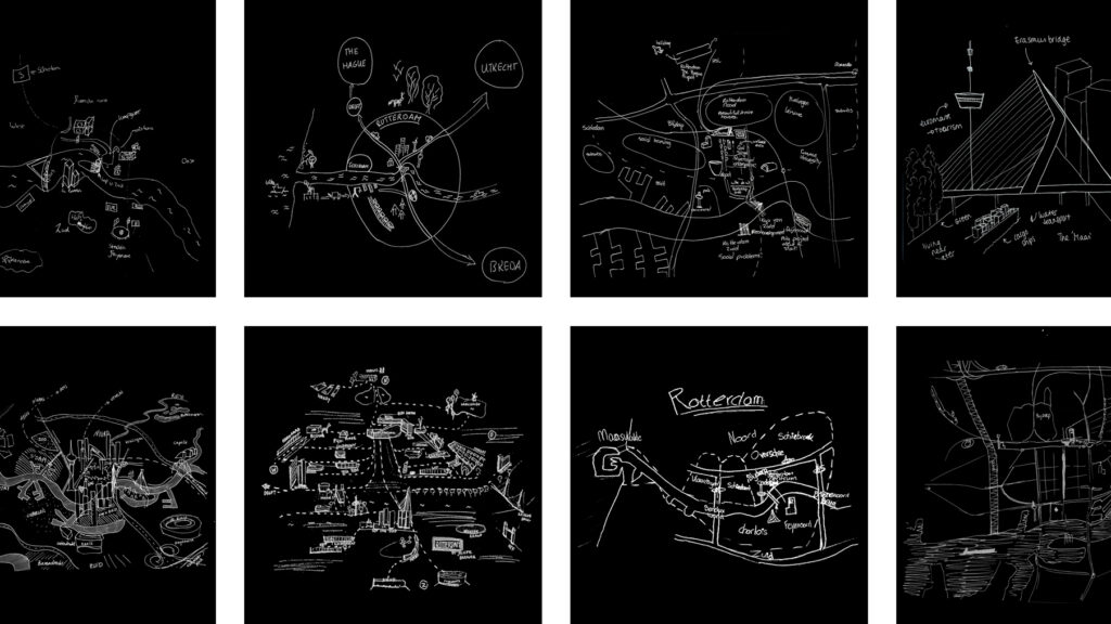
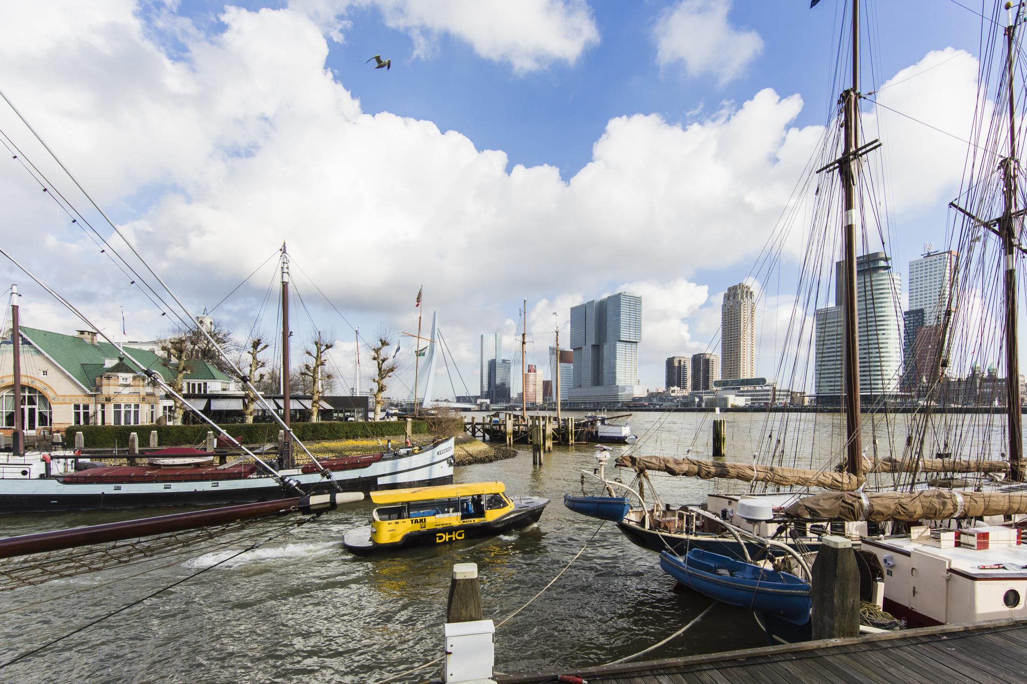
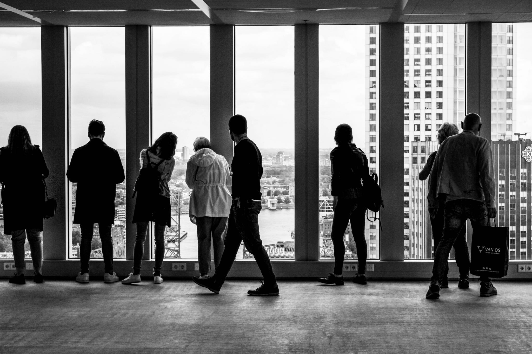
This article makes explicit why, at first, we do not usually think beyond water, docks, cargo, moving loads, and ships when we think of port-cities. By reviewing mental maps of port-city Rotterdam drawn by professionals in training, it becomes clear that the adjective ‘port’ modifies the meaning of ‘city’ in such an extent that this echoes in the mind. It does exceptionally when respondents are asked explicitly to draw the ‘port-city’ by mind. Port and city seem to have become conceptual dichotomies. In the case of Rotterdam, the established professional points of views seem to be aligned with this disunion, even though the current trend in practice turns towards a desire to (re)develop the port-city as one. Through similar mental mapping experiments on Rotterdam, yet without adding the label of ‘port-city’ in the question, much richer images of the port-city of Rotterdam are generated. Multi-scalar reviews of such maps help to explicate much more inherited relations between nature and artifice, as well as for example the flows of goods and people. Ultimately, this approach changes the perspectives on the port-city, also for professionals in practice.
Read:
Harteveld, Maurice (2021b) Images of Port-City Rotterdam, through the Mental Mapping Methods. In: Portus, the Online Magazine of RETE (Association for the Collaboration between Ports and Cities), No. 42-2021, Year XXI. RETE Publisher, Venice, ISSN 2282-5789
Port Cities as Hubs of Diversity and Inclusivity: The Case of Rotterdam
9 June 2020
Article by Carola Hein, Paul van de Laar, Maurice Jansen, Sabine Luning, Amanda Brandellero, Lucija Azman, Sarah Hinman, Ingrid Mulder, Maurice Harteveld (Leiden-Delft-Erasmus PortCityFutures)
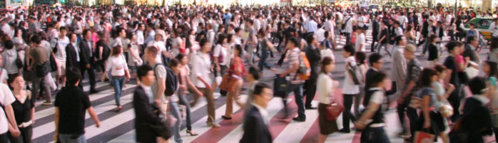
Port cities are a particular type of territory and are often long-standing examples of resilience, bringing opportunities, wealth, and innovation to their nations and their citizens. They have developed at the crossroads of international trade and commerce and the intersection of sea and land. Flows of people through trade and migration have played a key role in their spatial, social and cultural development. Their strong local identities share legacies of diversity and cosmopolitanism, but also of colonialism and segregation. The Qingjing Mosque in Quanzhou, Fujian speaks of the exchange between Arabia and China along the maritime silk road. Hanseatic cities stand as an example of far-flung networks with districts for foreign traders—think of the German merchants who established Bryggen, the German dock, in Bergen, now a UNESCO world heritage site.
Port cities are places that accommodate change —and often thrive as a result. As logistical patterns, economic organization, spatial structures and technological devices have evolved, port cities have consistently provided spaces and institutions to host changing social, cultural and demographic needs and have built their local identities around them. Chinatowns, for example, are emblematic of many port cities worldwide. For many centuries, traders and merchants depended on the interaction between local traders and short- and long-term migrants of all classes. To maintain and facilitate shipping, trade or organizing defenses, traders, workers, and citizens have come together and developed long-term strategies and inclusive governance systems. Built around trade, these shared practices have not always benefitted everyone. Colonial port cities hosted the buying and selling of enslaved people as well as minerals, animals and opium. Many workers lived in squalid conditions in walking distance to the port. The degree of tolerance and inclusion depended on the extent of ethnic diversity overall, the degree of spatial and social segregation in the city, and the economic structure of the urban economy.
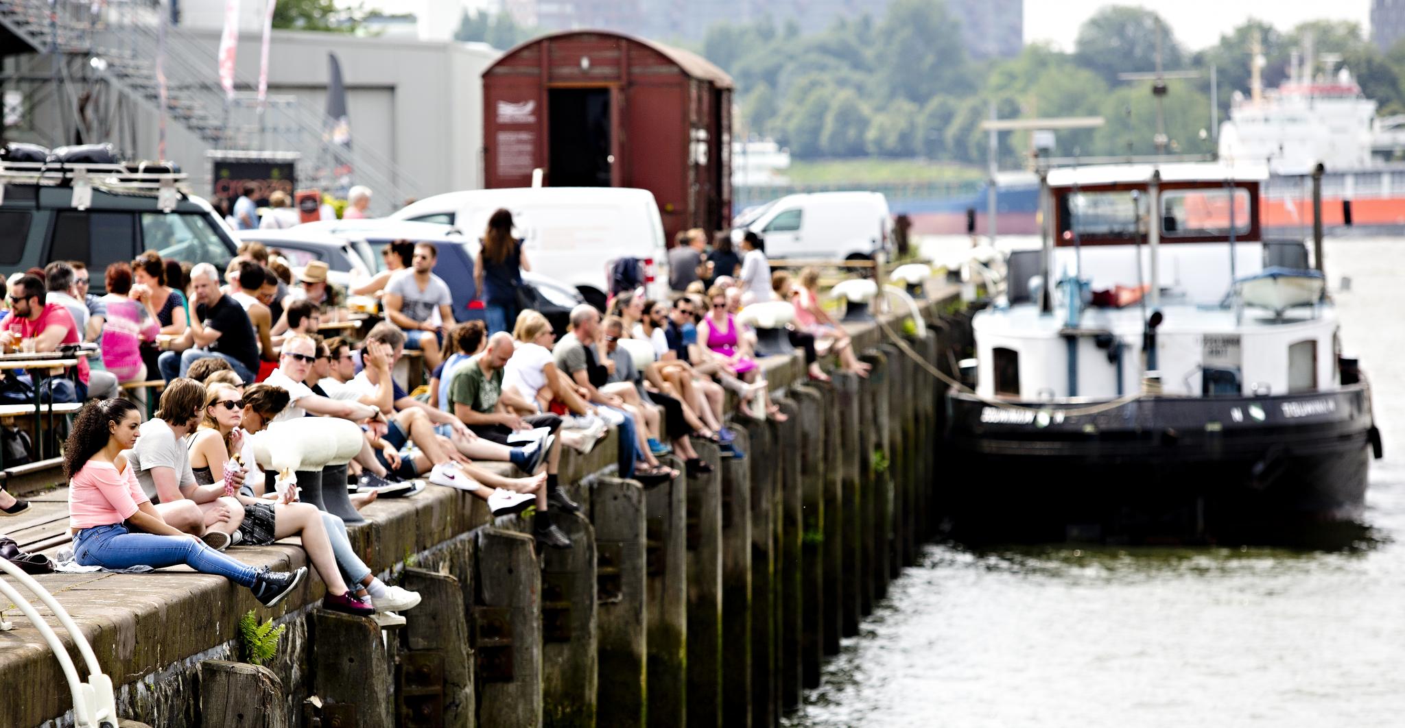
Waterfronts have been and in some (smaller) cities still are contact zones of people from diverse backgrounds: public spaces bring together dockworkers, displaced people, casual labourers, and trans-migrants waiting to board ships for overseas travel. However, waterfronts have been looked upon as places of otherness in need of social reform even at the turn of the twentieth century. Since the 1960s, container districts and offshore ports further increased the separation between ports and cities. Following containerization, waterfront regeneration has become a worldwide tool to overcome the range of social, cultural and public health issues associated with the nineteenth century waterfront. Urban renewal and gentrification have been central to many of these programs that took off beginning in the 1980s in most European port cities. Rebranding has been an essential part of bringing new capital and new people into neighbourhoods next to former dock areas, which normally would not have been of interest to private investors. In select cases—such as HafenCity Hamburg—planners and politicians have consciously opted for spatial and social inclusion.
Rotterdam as a port city reflects the long-term history of migration traditionally related to shipping and trade in all aspects, but since the 1970s the working port is no longer a decisive pull factor. Other international, national and local factors have changed the city’s population characteristics. The past decades have seen increasing diversity in ethnic groups and religions but also increased variation in socio-economic statuses among inhabitants with a migration background. Rotterdam hosts so many ‘minority’ migrants that it is now considered a superdiverse city where 52%, and in some districts, almost 70% of the population have a migrant background.
Rotterdam’s hyperdiversity—a term meant to acknowledge the multiple causes of diversity—has challenged existing local integration policies. The city government’s development strategy focusses on a balanced composition of the population and regeneration programs in combination with new residential, sustainable urban planning and branding strategies aim to assure integration. Like other cities with major waterfront revitalization activities, Rotterdam is witnessing a gap between cosmopolitan aspirations boosted by international capital and symbolic waterfront architecture and the existing reality of a hyperdiverse population inhabiting the urban fabric. Redevelopment projects of former waterfront port areas, such as Lloyd Quarter, RDM and M4H stand as examples. Yet, like other cities with major waterfront revitalization activities, the question arises: to what extent is Rotterdam widening the gap between diverse neighbourhoods and gentrified port-city redevelopment projects? There is a potential risk of economic segregation as authorities, educational and cultural institutions aspire to build the post-industrial economy on the port industrial foundations of the past, neglecting those areas where a linkage to the maritime mindset of Rotterdam as a port city is hardly felt let, alone visible.
Rotterdam needs to find ways to come to terms with political, economic, social, and cultural dimensions of its port city. That is one of the major challenges for Rotterdam in becoming an inclusive city. What is needed to connect Rotterdam’s migration narrative (and that of other port cities) to further the inclusive city ambition, using its present hyperdiversity, and acknowledging the value of diversity for creativity, innovation and making the next port city? Exploring the key values of an inclusive post-industrial, hyperdiverse port city drives the research agenda of our multidisciplinary LDE PortCityFutures program.
The Leiden-Delft-Erasmus PortCityFutures program employs multi-disciplinary methods and longitudinal perspectives to understand and design political, economic, social, and cultural dimensions of spatial use in port city regions. It explores how the flows of goods and people generated by port activities intersect with the dynamics of the natural environment, hydraulic engineering, spatial planning, urban design, architecture, and heritage. It examines the spatial impact of competing interests among port-related and urban spatial development needs and timelines. It explores creative solutions and design measures to problems and considers their implications for the future use of limited space that will allow port, city, and region to thrive.
This website uses cookies to improve your experience. We'll assume you're ok with this, but you can opt-out if you wish.AcceptRead More
Privacy & Cookies Policy
Privacy Overview
This website uses cookies to improve your experience while you navigate through the website. Out of these, the cookies that are categorized as necessary are stored on your browser as they are essential for the working of basic functionalities of the website. We also use third-party cookies that help us analyze and understand how you use this website. These cookies will be stored in your browser only with your consent. You also have the option to opt-out of these cookies. But opting out of some of these cookies may affect your browsing experience.
Necessary cookies are absolutely essential for the website to function properly. This category only includes cookies that ensures basic functionalities and security features of the website. These cookies do not store any personal information.
Any cookies that may not be particularly necessary for the website to function and is used specifically to collect user personal data via analytics, ads, other embedded contents are termed as non-necessary cookies. It is mandatory to procure user consent prior to running these cookies on your website.