Port-City Perspectives


Infographic of the Comparative Analyses on the two Sets of Mental Maps

In the Minds of People: The Case of Rotterdam

Following the geographical ‘Any-Port Model’, urban design has stipulated and enforced the disunion of port and city over the recent decades. In conjunction with other disciplines, the emphasis has been laid at the dislocation of production activities in favour of logistic-productive dynamics. At the same time, the professional focus was on the urban areas where most citizens are. While this practice has led to the redevelopment of abandoned harbour areas too, foremost the approach stimulated stronger physical boundaries between lived city and the remaining and new harbour areas. This article describes the application of the dominant model in Rotterdam over the recent decades, on the basis of literature review, and, it confronts this with the concepts of Rotterdam which are in the minds of professionals-in-training, through the method of ‘mental mapping’. On the one hand, mainly harbour areas are memorised when respondents are asked to draw the port-city of Rotterdam, even though its efficient port infrastructure makes public space in these areas rare, and most harbours are located behind inaccessible borders. On the other hand, civic areas, which have a refined network of public spaces and are places for daily life, reveal also all kinds of tangible and intangible signs and symbols related to characteristics of the port-city when memorised; even more. Various elements, linked to water-land or the flows of goods, people, and ideas, dominate the minds of the people when they think of Rotterdam in general. These outcomes reconfirm the unique unity of port and city and provide a way to find an alternative or supplementary model accepting the complex nature of port-cities.

Read:
Harteveld, Maurice (2021) In the Minds of People: Port-City Perspectives, The Case of Rotterdam, In: European Journal of Creative Practices in Cities and Landscapes (CPCL), Vol. 4, No. 2.

See also:
Maritime Mindsets
Biographies of Places

Maritime Mindsets

Images of Port-City Rotterdam, through the Mental Mapping Methods

This article makes explicit why, at first, we do not usually think beyond water, docks, cargo, moving loads, and ships when we think of port-cities. By reviewing mental maps of port-city Rotterdam drawn by professionals in training, it becomes clear that the adjective ‘port’ modifies the meaning of ‘city’ in such an extent that this echoes in the mind. It does exceptionally when respondents are asked explicitly to draw the ‘port-city’ by mind. Port and city seem to have become conceptual dichotomies. In the case of Rotterdam, the established professional points of views seem to be aligned with this disunion, even though the current trend in practice turns towards a desire to (re)develop the port-city as one. Through similar mental mapping experiments on Rotterdam, yet without adding the label of ‘port-city’ in the question, much richer images of the port-city of Rotterdam are generated. Multi-scalar reviews of such maps help to explicate much more inherited relations between nature and artifice, as well as for example the flows of goods and people. Ultimately, this approach changes the perspectives on the port-city, also for professionals in practice.

Read:
Harteveld, Maurice (2021b) Images of Port-City Rotterdam, through the Mental Mapping Methods. In: Portus, the Online Magazine of RETE (Association for the Collaboration between Ports and Cities), No. 42-2021, Year XXI. RETE Publisher, Venice, ISSN 2282-5789

EN / ES / PT / IT

See also:
Biographies of Places
Port-City Perspectives

Expo SubTerra

New Roots for Underground Urbanism – Exhibition


photo by Joran Kuijpers

City x Space: Cross-Section Thinking

How can the integral and multifunctional use of public space, subsurface, and buildings -within a densified urban environment – create space and value that contribute to an attractive and future-proof living environment?

“This seminal question generates various answers depending on the specific context and location of asking. International interdisciplinary students from Delft University of Technology have outlined various design solutions. Manifest in all cases are the spatial bottlenecks on the level of public space. Connecting the intervention areas with the surrounding socio-spatial networks, therefore, forms the basis of all solutions. In addition, in the densification challenges we see the attention for the multi-layered space: on the one hand, a train or metro station, for example, generates flows of people at several levels; on the other hand, building in higher densities and/or living and working in collectives, generates new shared spaces.” As Maurice Harteveld explains in the exhibition; “The hybridization of the urban and architectural program also requires a cross-section thinking. This can be seen in future-proofing both large-scale sports or industrial areas, as well as small-scale residential houses in neighborhoods where work is shifting to local entrepreneurs and home workers. Finally, the subsurface plays an important role in greening the living environment and in water storage.”
Continue reading

Images of Port-Cities

In this video, you will get an explanation on how mental maps help us to (re)imagine port-cities in two steps: First, by explaining generally why people draw what they draw, and second, by explaining how images of port cities, as displayed in mental maps, are rooted and influenced by cultural frameworks of experience, and how they are biased according to the particular background of the beholder.

This educational video is part of the course Re-Imagining Port Cities: Understanding Space, Society and Culture available for free via online-learning TUDelft , and at the EdX MOOC platform. ©️ TU Delft, released under a CC BY NC SA license.

See also: the introduction video on Mental Mapping and the full MOOC on EdX: (Re)Imagining Port Cities: Understanding Space, Society and Culture

Mental Mapping

In this video, you hear more about the concept of a ‘mental map’, the mapping method, or the underlying theory, and why it matters, and how you can use it to educate others.

But before you watch, choose a port-city, and do a small exercise: sketch a map of your port city from memory.

If you have trouble getting started, just imagine you are walking through your port city. What would you see on the way? Are there specific elements or landmarks that stand out? Those are the kind of elements to include in your map. And don’t worry about getting all the details exactly right, it is just a sketch…

  • Do this all by yourself: close your laptop, put your tablet to sleep, turn your smartphone around, do not consult any books, and do not talk to anyone…
  • Draw your map on a blank, unlined sheet of paper, and don’t spend more than ten minutes on this task!

    Don’t worry about details; this map is not meant to be perfect!

    This educational video is part of the course Re-Imagining Port Cities: Understanding Space, Society and Culture available for free via online-learning TUDelft , and at the EdX MOOC platform. ©️ TU Delft, released under a CC BY NC SA license.

    See also: the subsequent video on Images of Port Cities and the full MOOC on EdX: (Re)Imagining Port Cities: Understanding Space, Society and Culture

  • City x Space

    In the spring of 2021, the Delft University of Technology, COB Platform of Subsurface Construction, the Environmental Department of the Flemish Government, and the Deltametropolis Association have started a design study exploring the possibilities of integral and multifunctional use of space within highly densified cities. Design consortia from practice have been invited to choose from a number of cases in The Netherlands and Flanders involving spatial bottlenecks in ​​public space, subsurface, and buildings. Seven teams have already started.

    Underground Use of Space as a Game-Changer
    Due to the convergence of a multitude of tasks and transitions (energy, climate, circularity, mobility) in ever densifying cities, the pressure on public space is increasing. It is especially today because these cities also have to absorb a large share of the housing assignment, following the aims to preserve the rural landscape as well as to reduce the pressure on the current mobility system. However, how much densification is (still) possible for locations that are already overloaded with functions and programs and where the public space – both above ground and below ground level – threatens to silt up and get stuck?

    Current and future space claims require careful consideration of the options for using space more effectively and efficiently, with the aim of increasing the ‘spatial efficiency’ of the city in an innovative way.

    In the design study, partners focus on a different view of the organisation of urban programmes and transition tasks while they search for new ways of thinking, patterns, and solutions for integral and multifunctional use of space from the cross-section.

    The central question:

    How can integral and multifunctional use of public space, subsoil, and buildings within a densified urban environment create space and value that contribute to an attractive and future-proof living environment?

    The design study has resulted in various spatial designs with visions of the future and implementation strategies. A number of urban locations as case studies are being worked on, namely Ostend, Rotterdam, Amsterdam, Mechelen, Leuven, and Maastricht. For each case study, a multidisciplinary team was selected (in Rotterdam 2) of spatial designers (architects, urban planners, landscape architects), engineers, and the experts required for underground developments such as geo-technicians.

    Stad x Ruimte / City x Space

    Partners:
    Centrum voor Ondergronds Bouwen / COB Platform of Subsurface Construction
    Departement Omgeving Vlaanderen / Environmental Department of the Flemish Government
    Deltametropolis Association / Vereniging Deltametropool

    B1ts of Publ1c Space

    As an opening for the Bits of Public Space 3.0 webinar, I have taken the audience along with a short story.

    Imagine: You are walking in a public space, and you are using your navigation app to meet at a place, which your friends suggested a few seconds ago on WhatsApp. Your headset is on. Noise is reduced. While walking, you’re traced and tracked; the shortest and fastest route is recalculated continuously, In the mean, a health app may record your cycles, Spotify remembers your music preferences, many other web-data fuel the algorithms, …and synchronically all kinds of devices around you sense your environment too. Every detail is collected for third-parties. Also webcams and what looks like cctv register where you are. They monitor your moves and avoid the unexpected to happen. This morning, the weather app has announced rain. Indeed, while clouds make it shimmer, your smart screen illuminates, and lamps turn on.

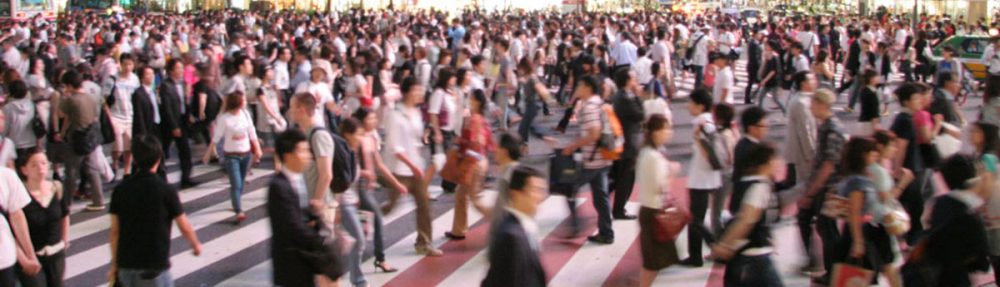
    You’re still walking… People don’t walk close. This makes you think of what you have read this morning: In some cities, drones are measuring social distance, today, and if too close, through image recognition big brother sends you a fine. – In the mean, a car is passing by smoothly. Your mind links it to the lecture on self-driving vehicles. They are keeping distance automatically… “Who is behind the wheel, btw?” You can’t see. Humanoids, perhaps…? Anyways.

    Back to your walk. You have to pay attention for a minute to the surrounding, while you are crossing a street. (Small sensors, have made traffic lights turn green for you.) You are starting to be curious to the place where your friends are waiting. They have been involved in the redesign of this meeting space. Some years ago, one would outline public spaces with computer-aided design. You remember how outcomes have always been presented in ‘sunny’ artist impressions. But, during its realisation, budget restrains always made such a plan somewhat more realistic… Today is a different world. Tools are innovating, and include components ranging from environmental analysis to robotic control. The old outlines may still work… Yet, simulations of human behaviour in space helps to understand complexity. The design of public space can be informed more accurately by our updated models, and digital twins. Automation and print-on-demand can still make old dreams happen. You have seen new video presentations of the place, where you’re heading to, on the internet; they are quite realistic. You’re convinced as a designer, your imagination benefits the people, but alike your friends, nobody is alone in design. Online meetings are integrating viewpoints of other experts and novice users. Webinars are bringing people, ideas, and living rooms, closer together. It may be enriching. Yet, the design of your friends may never be finished. Invitations by Zoom, Meets, Facetime, Webex, Slack, Trello, Miro, Messeger, or Teams are following up. #multionline #haveitall – Also, participatory platforms have invited as many users as possible, to join VR sessions and visit the augmented space, to be. Some of the users have replied and have worked within the framework of your friends, their concept of the future. But for some it was not enough… On Insta, some users have found a better idea. As pro-active citizens, they have organised themselves on social media, via transnational networks and microblogging they have got more inspiration. Tutorials have helped them to learn the trick. Public space design changes in a kind of grassroots development, including peer-2-peer exchange of probably two unfamiliar neighbours. The one simply likes gardening, the other orders always outdoor stuff on discount pages. The pro-active group of users co-create and make the space theirs.

    Thoughts fade away; You’re still walking…. Happy you. You are almost there, at the meeting place, where everybody seems active. You see your friends coming near. It’s a really nice place. Not as slick as you thought before, but you like it! “We would have liked to introduce a moving beam here…” on of your friend says: “People would love to sit on such a thing, really.” “It adjusts its position and form in accordance to their moods and likes”, the other adds… – You reply dry: “This bench works for me too”. While you are scanning the surrounding facades for heritage details, your friends starts to discuss hyperrealities, and phygital spaces …endlessly. In the mean, you are distracted by a piece of planting in front of you. It is a bid unorganised, and it seems organically grown, obviously added by the community. It looks like one of those greens, which you must have seen in ‘Spaceship Earth’, the movie, which you screened on your laptop, pay-per-view, during the opening night of the Architecture Film Festival Rotterdam, last month. After a long chat on the ‘future on being’, you really want to leave again. Your eyes are dry and your mind is tired. You are suggesting to play more together next time and relax a bit. You have heard that they have launched a brilliant new ‘massive multiplayer online role-playing game’ Then everybody leaves, and walks away

    This is the end of my story…

    What do you think: How have you listened to the story: Have you been walking and talking in reality? Or was it your avatar in cyberspace? Near everything in this story is out there. It affects your profession everyday as an designer. Everything is existing as real space as well as virtual space

    This story is recorded with a live audience via YouTube on Friday, November 5th, 2.00 – 9:00am CET. – The webinar has been part of the initiative the POLIS Urbanism and Landscape Architecture Week, of Polis

    Among Academic Avatars


    The opening of another academic year, but – in 2020 – Delft students, academics, and others met in a replica virtual campus while searching for the TU Delft flames in a game.

    Mapping Maritime Mindsets: Mental Maps

    Imagine: You are asked to draw a port city from memory. What would you put on paper? Do you think of harbours? Water, docks, cargo, moving loads, and ships? If your drawing shows these elements, don’t be surprised. Sixty-five graduate students also took on the challenge. In answering: “draw the port city of Rotterdam by mind”, the drawings of the participants (fig.1) displayed exactly the above features. Of course, this makes sense. A port just happens to be a place on the water in which ships shelter and dock to (un)load cargo and/or passengers. A harbour is a sheltered place too, and in its nautical meaning, it is a near-synonym for sheltered water, in which ships may dock, especially again for (un)loading. So, all the above linguistic lemmas are there and all these are connected to imaginable objects.

    Keep reading on Port City Futures | Leiden•Delft•Erasmus

    Architecture in Urban Change

    Designers are questioning what architecture of relevance could face ongoing change over a longer period in today’s most dynamic urban areas. Of course, answers are always specific and the search on how to respond to constantly changing urban conditions may be the only issue that is shared in all cases. Yet, still, there must be more commonalities in the wide range of answers. The set of design propositions as presented at the Ecole Nationale Supérieure d’Architecture de Versailles (ENSA-V) underlines this, while designs display a few recognisable approaches. Projects put the emphasis on the importance of intervening at strategic locations, of programming adaptive and responsive, hence flexible, and of imagining and creating expressions that will enhance public interaction and experience over a longer period. As a guest of the school, I have the opportunity to review these thoughts and discuss emerging approaches with prof Nicolas Pham.

    l’Ecole Nationale Supérieure d’Architecture de Versailles
    Champ disciplinaire de Théories et Pratiques de la Conception Architecturale Urbaine (TPCAU)
    5 Avenue de Sceaux, Versailles
    20 December 2019, 9:30-17:30h