Maritime Mindsets

Images of Port-City Rotterdam, through the Mental Mapping Methods

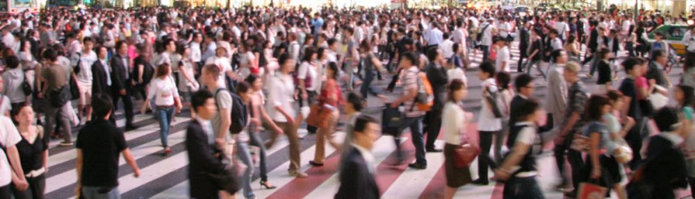
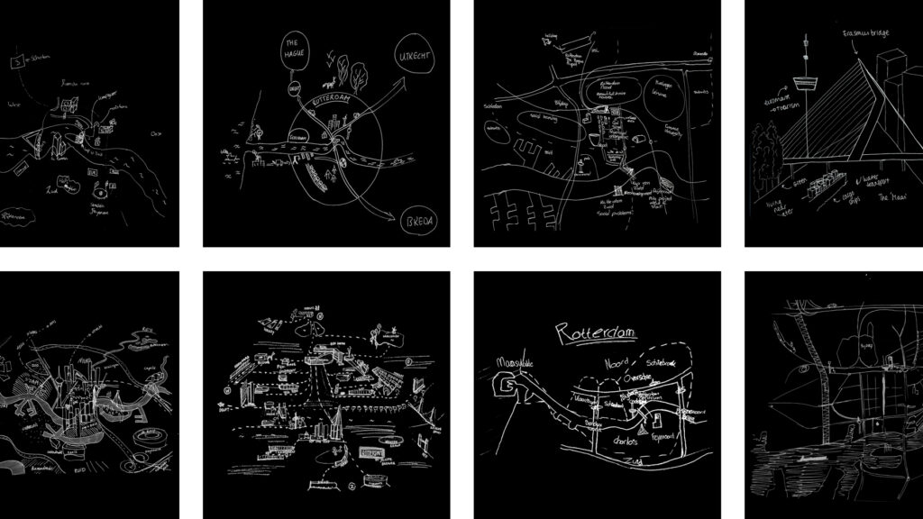
This article makes explicit why, at first, we do not usually think beyond water, docks, cargo, moving loads, and ships when we think of port-cities. By reviewing mental maps of port-city Rotterdam drawn by professionals in training, it becomes clear that the adjective ‘port’ modifies the meaning of ‘city’ in such an extent that this echoes in the mind. It does exceptionally when respondents are asked explicitly to draw the ‘port-city’ by mind. Port and city seem to have become conceptual dichotomies. In the case of Rotterdam, the established professional points of views seem to be aligned with this disunion, even though the current trend in practice turns towards a desire to (re)develop the port-city as one. Through similar mental mapping experiments on Rotterdam, yet without adding the label of ‘port-city’ in the question, much richer images of the port-city of Rotterdam are generated. Multi-scalar reviews of such maps help to explicate much more inherited relations between nature and artifice, as well as for example the flows of goods and people. Ultimately, this approach changes the perspectives on the port-city, also for professionals in practice.

Read:
Harteveld, Maurice (2021b) Images of Port-City Rotterdam, through the Mental Mapping Methods. In: Portus, the Online Magazine of RETE (Association for the Collaboration between Ports and Cities), No. 42-2021, Year XXI. RETE Publisher, Venice, ISSN 2282-5789

EN / ES / PT / IT

See also:
Biographies of Places
Port-City Perspectives

On Public Interior Space

In the city today, we meet in public atria and shop in malls, we move along covered walkways and go from street to street by taking shortcuts through the buildings of a city block. In recent decades, the amount and proportion of public space within urban buildings has steadily increased, with much of it forming part of a larger interior and exterior pedestrian network. Yet, although interior public space has become an important constituent of the contemporary city and of our urban experience, it is rarely designed as such. Prompted by this disconnection, Maurice Harteveld has followed different leads to examine contemporary urban design in relation to public interiors. Through this research, he has documented in particular the urban analyses and architectural designs of Robert Venturi and Denise Scott Brown, in which interior public space is accorded significant and multiple roles. Ideas pioneered by Venturi and Scott Brown have become absorbed within architectural practice, notably their use of the Nolli Map introduced in their 1972 study of Las Vegas. Similarly, the concept of the ‘rue interieur’ seen in their earliest projects, has matured in their later work to include an internal street imbedded in a network of urban public spaces and pathways, both interior and exterior. However, although they refer to interior public space frequently in their writing, Venturi and Scott Brown have yet to describe their views on it in any great detail; a more focused examination that the following dialogue between Maurice Harteveld and Denise Scott Brown seeks to provide.

Continue reading