Biographies of Places

Today, historiographies seem to have moved away from traditional political and diplomatic histories describing cities towards social and cultural approaches. In general, this current shift of interest follows a Late-Modern turn toward the marginalized and marginalizing evidence, and thus explicit hypotheses are tested, and, among others, unbiased data is collected by current biographers. Still, certain narratives stay manifest. Also in Rotterdam. Here, bifocal narratives on the world port and the cosmopolitan city, and the dichotomy among these territories, remain persistent in the most recent biographies. What is seen in everyday space does not match this ontology generally applied in Rotterdam. To greater extent, as such, the samples of the biographies of public spaces as places help to fulfill the most essential public function of researching and abiding justification, while reinvigorating the critical public present in spaces. By opening up to the multiplicity of narratives, the article ‘The Port-City Portrayed in its Public Spaces: Introducing Micro Biographies of Places’ is able to focus on descriptions of Rotterdam which fall outside the scope of the current conventional. Through the lens of ‘biographies of places’, this study particularly follows the so-called material turn, in difference to stories of lives or narratives on actor networks. Hence buildings and artifacts placed in context, are the principal unit of analysis, for a multidimensional interpretation of urban sites across regions and periods.

The approach is operationalized by linking the urban and architectural design of public space, with studies of urban history, literature, cartography, and other urban humanities. This integrated perspective on port-cities is put forward most recently in a wider variety of projects at the LDE Centre of PortCityFutures, which has been promoted and supported for the approach below.

Harteveld, M.G.A.D. (2021) The Port-City Portrayed in its Public Spaces: Introducing Micro Biographies of Places. In: PortusPlus: the Journal of RETE (Association for the Collaboration between Ports and Cities). Venice: RETE, Vol. 12.

See also:
Port-City Perspectives
Maritime Mindsets

Maritime Mindsets

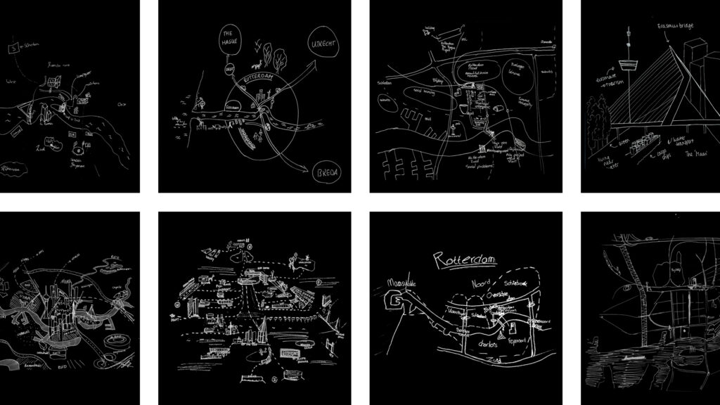
Images of Port-City Rotterdam, through the Mental Mapping Methods

This article makes explicit why, at first, we do not usually think beyond water, docks, cargo, moving loads, and ships when we think of port-cities. By reviewing mental maps of port-city Rotterdam drawn by professionals in training, it becomes clear that the adjective ‘port’ modifies the meaning of ‘city’ in such an extent that this echoes in the mind. It does exceptionally when respondents are asked explicitly to draw the ‘port-city’ by mind. Port and city seem to have become conceptual dichotomies. In the case of Rotterdam, the established professional points of views seem to be aligned with this disunion, even though the current trend in practice turns towards a desire to (re)develop the port-city as one. Through similar mental mapping experiments on Rotterdam, yet without adding the label of ‘port-city’ in the question, much richer images of the port-city of Rotterdam are generated. Multi-scalar reviews of such maps help to explicate much more inherited relations between nature and artifice, as well as for example the flows of goods and people. Ultimately, this approach changes the perspectives on the port-city, also for professionals in practice.

Read:
Harteveld, Maurice (2021b) Images of Port-City Rotterdam, through the Mental Mapping Methods. In: Portus, the Online Magazine of RETE (Association for the Collaboration between Ports and Cities), No. 42-2021, Year XXI. RETE Publisher, Venice, ISSN 2282-5789

EN / ES / PT / IT

See also:
Biographies of Places
Port-City Perspectives

Images of Port-Cities

In this video, you will get an explanation on how mental maps help us to (re)imagine port-cities in two steps: First, by explaining generally why people draw what they draw, and second, by explaining how images of port cities, as displayed in mental maps, are rooted and influenced by cultural frameworks of experience, and how they are biased according to the particular background of the beholder.

This educational video is part of the course Re-Imagining Port Cities: Understanding Space, Society and Culture available for free via online-learning TUDelft , and at the EdX MOOC platform. ©️ TU Delft, released under a CC BY NC SA license.

See also: the introduction video on Mental Mapping and the full MOOC on EdX: (Re)Imagining Port Cities: Understanding Space, Society and Culture

Mental Mapping

In this video, you hear more about the concept of a ‘mental map’, the mapping method, or the underlying theory, and why it matters, and how you can use it to educate others.

But before you watch, choose a port-city, and do a small exercise: sketch a map of your port city from memory.

If you have trouble getting started, just imagine you are walking through your port city. What would you see on the way? Are there specific elements or landmarks that stand out? Those are the kind of elements to include in your map. And don’t worry about getting all the details exactly right, it is just a sketch…

  • Do this all by yourself: close your laptop, put your tablet to sleep, turn your smartphone around, do not consult any books, and do not talk to anyone…
  • Draw your map on a blank, unlined sheet of paper, and don’t spend more than ten minutes on this task!

    Don’t worry about details; this map is not meant to be perfect!

    This educational video is part of the course Re-Imagining Port Cities: Understanding Space, Society and Culture available for free via online-learning TUDelft , and at the EdX MOOC platform. ©️ TU Delft, released under a CC BY NC SA license.

    See also: the subsequent video on Images of Port Cities and the full MOOC on EdX: (Re)Imagining Port Cities: Understanding Space, Society and Culture

  • Interior Public Space

    Thesis Presentation
    16th January 2014, 12:00h

    Delft University of Technology
    Aula Congress Centre, Senate Room
    Mekelweg 5
    Delft

    ‘Interior Public Space, On the Mazes in the Network of an Urbanist’ is the result of ten years of scientific research on the evolution of interior public spaces. It explores the development of the phenomenon in a time era when general accepted theoretical understanding on public space in urbanism has been established, increasingly neglecting or even rejecting the existence of public spaces within the interior. The subject is, and the research cases have been very international. They uncover relatively unknown knowledge and in syntax they are recombined to achieve new and unexpected insights.

    Continue reading

    Mazes in the Network

    Interior Public Space
    On the Mazes in the Network of an Urbanist

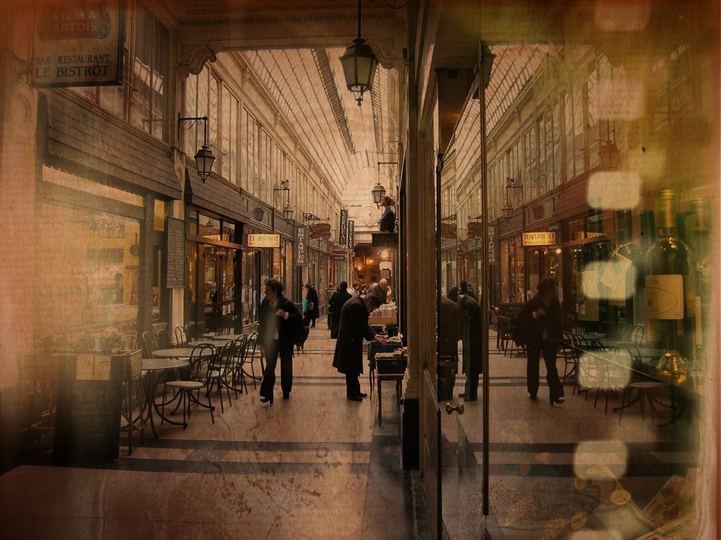
    For centuries – and increasingly often today – the term ‘public space’ has been a synonym for government-owned spaces, open for all, and known by everyone. According to me, this is a complete misnomer. The spaces that people actually use are forgotten. Subordinated and neglected, considered unimportant by many urban theorists; the thinking on public interiors as day-to-day public space is in a poor way. The theorists who do pay attention to public spaces almost always accord them a separate status, and describe them as ‘semi-public’ or ‘collective’ spaces, neither public nor private. I base my views on the influence that people themselves have on the public character of a space.

    Interior public spaces are exemplary. They are certainly not have become a new phenomenon, as some contemporary researchers suppose. They have always played an important part in various social-spatial changes and have been crucial to cities and their culture. I have studied the development of Graeco-Roman thinking on public space up to present day, and measured it against architectural and urban design practice. My research is based not just on theoretical premises or on political aims. It is based on the many designs in practice, which have been realised in various Indo-European cities, in the Turkish and Arabian countries in their periphery and in the Japanese capital, during and after the period of ‘westernisation’. My thesis can therefore also be seen as the scientific journey of a designer, close to day-to-day practice.

    I believe that everyone makes a space, not just a designer. This involves a redirection of our thinking: Until theorists come to respect all public spaces and understand the complex network of people, they will lose their way in their self-made mazes.

    Cover of Interior Public Space, by Maurice Harteveld

    see:
    Harteveld, Maurice (2014) Interior Public Space, On the Mazes in the Network of an Urbanist, A Scientific Journey of a Designer, Following the Evolution of Greco-Roman Thoughts, Through Some Remarkable Indo-European Cities, Including those in The Americas, Crossing the Turkic and Arabic Spheres in their Proximity, and Abridging to the Japanese Capital as Introductory Exemplar, to Reconstruct Today’s Reasoning on Public Interiors by Means of Defining Types, Interrelating People and Actions, Describing Socio-Spatial Transformations, and Comprehending Cultural Meaning, In Nine Books; Delft: Delft University of Technology, Faculty Architecture, Urbanism and Building Sciences

    Find a copy in the library